Ludzīmā küläq: A Trip through Lutsimaa

In 1893, Estonian researcher Oskar Kallas journeyed through the Ludza area and recorded in his book published the next year, Lutsi maarahvas, Estonian-speaking inhabitants as living in 53 villages in the Ludza area. In 2013 and 2014, I’ve been revisiting these places and have been to about 40 of them now. Most are still inhabited, many have inhabitants that remember the Estonian (Lutsi) roots of themselves or their neighbors, others have inhabitants with no memory of Estonian origins. However, at least some of even these people have last names suggesting that they too may be descendants of Lutsi families known to previous researchers decades ago. Some villages, though, are completely gone for one reason or another. For some, such as Ščastļivi (Lutsi: Tati külǟ) this is quite a dramatic turnaround as before World War Ii it was one of several important Lutsi villages within Nirza pagasts (parish), yet now it is completely abandoned and inaccessible except by foot.
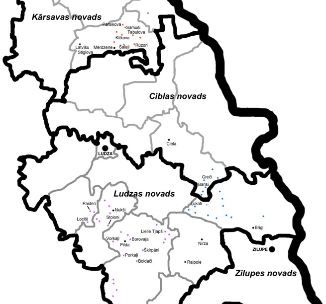
Some of the places shown below are not Lutsi villages themselves, but have importance to the Lutsis and their history. Ludza is the city at the center of their home territory and the city for which they are named. The Raipole Catholic Church has been of importance to the residents of the Pilda area -- Lutsi and otherwise -- and the Catholic Church in Latvīšu Stiglova has been of significance to the Lutsi and non-Lutsi residents of the Mērdzene area.
The villages are too numerous to easily display pictures from all of them for the moment, but perhaps in time I will find a way to do this. For the moment I wanted to include a representative selection of images from the Lutsi villages that Oskar Kallas saw at the end of the nineteenth century and that I have seen now as they are in the second decade of the twenty-first century.
I’ve given each image with its village name and then in parentheses written the broad area that I classify this village under (Pilda, Nirza, Mērdzene). The administrative divisions of Latvia have changed drastically over the course of the last 75 years and so I felt that it was just simpler and clearer to classify each of these places according to these three areas into which the villages can be fairly clear classified. The Pilda area is roughly to the south of Ludza, Nirza to the east, and Mērdzene to the north. Mērdzene is the most distant of these areas from Ludza.
Retracing Oskar Kallas’ journey


All images are copyright of Uldis Balodis. If you wish to use these images for any purpose, please contact me for permission first before doing so. Any other use without permission is not authorized.
The map below shows the location of the villages in the gallery. The villages shown in purple are associated with Pilda, those in blue are associated with Nirza, and those in orange are associated with Mērdzene. Other significant cities and villages are shown in black. The black boundaries show current administrative divisions (municipality or novads, in Latvian). The grey boundaries show the former smaller administrative units (parish or pagasts, in Latvian), which ceased to exist in 2009, but still are used for reference and appear on maps. It should be noted that in pre-World War II Latvia there also was an administrative unit called pagasts, but the boundaries of these differed from the pagasts units that existed again between the 1990s and 2009. Click here for a map showing the location of this area within Latvia.
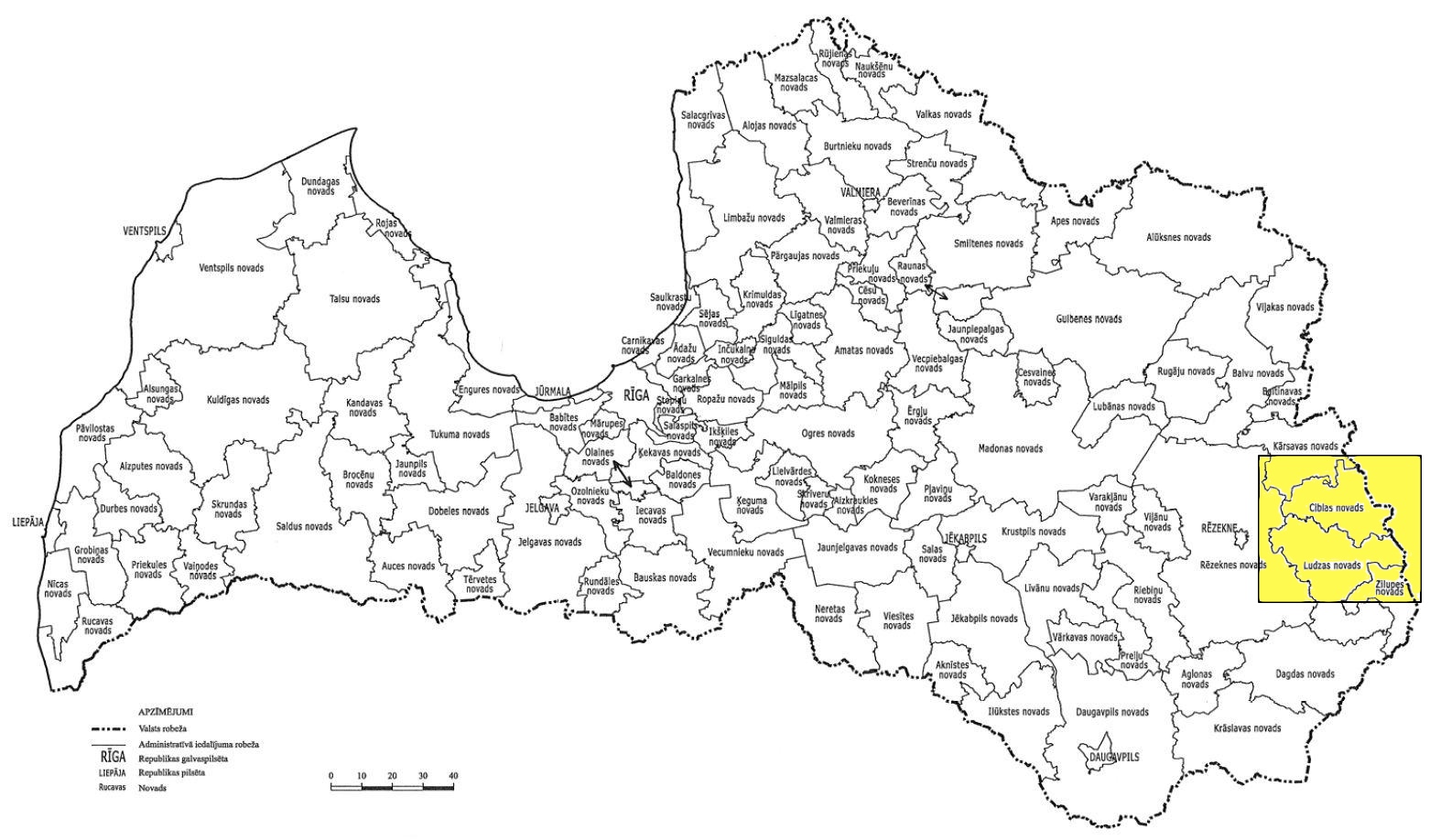
Location in Latgale
